The Shores Of The Ind River, And His Brother The Gung River Are Calling Us!..

We have passed through many cultures, and the globe still shows no end. Our journey continues — this time, the milestone before us points toward the land of the great pastoral banks of the Indus River.
As you are feeling, the time of socio-cultural background will describe the Indus region, replacing the Mediterranean lands.
The area of the region scattered widely from the Iran–Pakistan coast in the west to near modern Delhi in the east, and into Afghanistan to the north.
But the tribal sites were founded mostly along the Indus River basin shores, and these are exactly the core object of our review now.
For generalisation purposes, we may divide the region into eight sectors, each of them possessing its own uniqueness — both territorial and chronological.
Let us encounter them one by one, in such a manner as the rivers, never hurrying in their flow, and with respect to the greatness of the landscape we shall be crossing over.
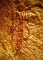
🏕️ Baluchistan Highlands (Mehrgarh and Associated Valleys)
Sites on the territory: Mehrgarh (Kachi Plain), Kili Gul Mohammad, Nausharo, Mundigak (Afghan border).
The archaeological sources discovered the settlements:
- Early domestication of wheat, barley, and zebu cattle (proposed by researchers, speculative).
- Mud-brick houses with multiple rooms (speculative, but possible).
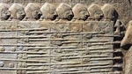
- Burial sites containing ornaments made of lapis lazuli, turquoise, and marine shells (evidence of trade links).
- Early copper tools and bead-making workshops.
The population here represented early agro-pastoral communities, sometimes identified with pre-Dravidian or proto-Indus substrata. The Mehrgarh culture is regarded as the cradle of South Asian Neolithic life, transmitting farming knowledge eastward to the Indus plains (indirect position of researchers, mostly).
The period of the sites we reviewed is framed as 7000–3300 BCE.
🏕️ Indus Upper Basin (Punjab – Ravi, Beas, Sutlej Region)
We are talking about the period 4000–2600 BCE.
- Settlements: Harappa, Kot Diji, Kalibangan I (early phase), Jalilpur.
Fundament for our speculation (sometimes about real archaeological artefacts):
- Development of mud-brick walled towns, small citadels, and grain storage (suggested, indirect).
- Handmade pottery with geometric motifs (real artefacts).
- Discovery of terracotta bull figurines, plough marks (Kalibangan), and seed remains showing organised agriculture (speculative suggestion, but as a theory has the right to be considered).
- Increasing standardisation of brick sizes and proto-writing marks on pottery (derivations from the artefacts, very probable to be true).
- Associated with the Kot Diji culture, possibly descended from Mehrgarh settlers who migrated eastward. This region likely included riverine agricultural clans and trade groups linking hill and plain (derivations based on generalised complex research).
🏕️ Sindh and the Lower Indus Basin
The period under review here is 3500–2600 BCE.
- Settlements under review: Amri, Mohenjo-daro (early levels), Chanhu-Daro, Kot Diji (southern type).
- Sources and speculations to list include pottery with painted patterns and wheel-made ceramics.
- Early fortified towns with planned street grids.
- Copper tools, shell ornaments, and faience objects.
- Increasing use of standardised weights and early trade with southern Mesopotamia (Dilmun–Ur) (derivations and suggestions based on artefacts).
All listed above encourage us to the outcome known as the Amri–Nal cultural horizon in its early phases. The tribal identity is uncertain but likely related to proto-urban trade groups developing long-distance connections. Their descendants evolved into the core urban population of Mohenjo-daro.
🏕️ Ghaggar–Hakra (Sarasvati) Region — Eastern Indus Fringe
Maybe it looks inconsistent with the timing, but we are not chasing date consistency; we are just walking the rivers’ shores, site by site. So now the period we are discovering in the region is dated as 3800–1900 BCE.
- The spots we found here are: Kalibangan I–II, Bhirrana, Banawali, Rakhigarhi.
- And what about the artefacts researchers supply us with? Early farming villages growing into towns along the dried Ghaggar–Hakra (often identified with the mythical Sarasvati River). And this assertion has a place to be alive, based on the following evidence.
- Kiln-fired brick architecture and grid-like layouts, seals, weights, and bead workshops of semi-precious stones (agate, carnelian) (partially derived from the excavations, but logically acceptable).
Continuous occupation from pre-Harappan to mature Harappan times (this is an absolutely disputable claim).
And now it is time for fantasy. The region reveals continuity from the Sothi–Siswal culture, possibly small farming clans who later integrated into the greater Indus network. They played a major role in maintaining the eastern trade and agricultural frontier.
🏕️ Gujarat, Kutch, and Saurashtra Peninsula
The timing turns us to the 3700–1900 BCE epoch, and there were Dholavira, Lothal, Rangpur, Surkotada, Kuntasi, and Loteshwar settlements. Of course, the names are in our modern reconstructed spelling, but that is what we have.
The evidence gives us the following: fortified towns with reservoirs and water-management systems (notably Dholavira). Evidence of salt extraction, shell processing, and maritime trade — surely hypotheses, but nevertheless may be considered as well-balanced arguments of human activity of the inhabitants of these sites.
- Early use of stone weights and proto-script marks derived from the excavated artefacts.
- Lothal’s dockyard indicates international commerce with the Persian Gulf.
- From all the above we may suggest that this region hosted the Anarta and Sorath traditions, representing local adaptation to the dry coastal ecology. Populations were skilled in trade and seafaring — likely proto-Dravidian speakers or coastal merchant tribes.
🏕️ Rajasthan and the Ahar–Banas Cultural Zone
The period, archaeologically dated to 3000–1500 BCE, and the artefacts show us the pastoral sites of Ahar, Gilund, and Balathal.
- What do the excavated remains uncover for us?
- Chalcolithic settlements with copper tools, wheel-made pottery, and mud-brick platforms as artefacts; and from the evident derivations, we may conclude that these are agricultural sites showing evidence of barley, lentil, and rice.
- Distinct ceramic style: black-on-red ware. Copper-smelting furnaces were found, showing independent metallurgical expertise.
Speculation, as our distinctive fashion dictates? The Ahar–Banas culture was semi-independent yet interacted with the Harappans through trade. Tribes here controlled copper resources and supplied materials northward. Some continuity is visible in later early-historic cultures of Rajasthan.
🏕️ Northern Frontier and Himalayan Foothills
- Our chronicle jumps to the 4000–1800 BCE period. The settlements recommended to us by archaeologists are Burzahom (Kashmir), Gufkral, Mandi, and Sarai Khola.
- The set of excavations and unearthed artefacts list the following evidence: pit dwellings, bone tools, hunting and fishing implements.
- Domestication of sheep, goats, and cereals (especially in Kashmir) may be supposed from the excavated finds.
- Interaction zones between Central Asian and Indian Neolithic groups may be supposed for these settlements, based on their location and artefacts.
- A speculative summary may also find its place here: populations possibly related to early Tibeto–Burman and Indo-Iranian movements. They maintained mountain trade links, bringing jade, turquoise, and obsidian southward.
🏕️ Central Indian Plateau and Deccan Neolithic (Peripheral Influence)
The timing related to the settlements period we are attempting to describe covers 2500–1500 BCE.
- The territory shows us, through discoveries by researchers, settlement spots such as Chirand, Inamgaon, Nevasa, and Daimabad.
- Scientists did great work to provide us with the evidence and outcomes about the life of the regional inhabitants of the mentioned period.
Neolithic to Chalcolithic farming villages using stone axes and copper tools serve as evidence of rice cultivation, cattle herding, and long-distance trade of beads and metals.
- Underscoring the facts and suggestions listed above, we conclude that Deccan populations were distinct but influenced by northern contacts. Daimabad yielded a bronze chariot sculpture, symbolically linking southern metallurgy with Indus artistic tradition.
Here, we will try to classify all the sites mentioned above and predict their potential socio-cultural evolutionary pathways.
Here, the authors will show, in a systematic scientific way, how to build a theory, design a hypothesis, and then derive outcomes to set them as patterns, which, in the next stage of the research procedure, will undergo probing for their credibility.
So, we have a collection of cultures (no need to list them here—just glance at the paragraph above). And what should scientists do? From experience, scientists know that every creature localized within a specific territory acquires certain characteristics dictated by environmental factors. For example, the hippo is so shaped by the factors of its territory that there must be lakes with mud, swamps, shores rich in plants and grasses—mostly bushes—a temperature range within a defined frame, and other environmental conditions. Dramatically changing these conditions leads to a decrease in the species’ population and may even result in its extinction. These predispositions show us the schema for collecting data, generalizing it, and classifying it into sets of objects, which later provide the predictive power of the scientific approach.
Just as described above, let's classify the listed cultures. From the described cultural characteristics, we may generalize them into two main groups by their specialization of activity. These categories are: metal working (basic knowledge of metallurgy), agricultural basics, animal domestication, and the use of river fauna as a significant resource supplement.
Now, classification stage. Index 0 we set to Baluchistan Highlands. Each culture will be scored by its cumulative evaluation, where metal knowledge +2, domestication +1, agriculture +1, fishing +0.5. So for index 0, we score [0] = metal(+2), domestication(+1), trading(+2). Indus Upper Basin (index 1), [1] = domestication(+1), agriculture(+1). Sindh and the Lower Indus Basin (index 2), [2] = trading(+2), metal(+2), agriculture(+1), domestication(+1). Ghaggar–Hakra (Sarasvati) Region (index 3), [3] = domestication(+1), agriculture(+1), trading(+2). Gujarat, Kutch, and Saurashtra Peninsula (index 4), [4] = fishing(+0.5), trading(+2), agriculture(+1), domestication(+1). Rajasthan and the Ahar–Banas Cultural Zone (index 5), [5] = metal(+2), trade(+2), domestication(+1), agriculture(+1). Northern Frontier and Himalayan Foothills (index 6), [6] = fishing(+0.5), domestication(+1). Central Indian Plateau and Deccan Neolithic (index 7), [7] = metal(+2), trade(+2), agriculture(+1), domestication(+1).
Precalculation will reveal the following: [0]:5, [1]:2, [2]:6, [3]:4, [4]:4.5, [5]:6, [6]:1.5, [7]:6. And these score ratings we will call the developmental scale of proto-society.
This section is purely speculative content, aimed at showing the reader the classification and evaluation approaches, but it contains no real scientific facts. Below, we will explore the actual historical evolutionary processes of the territory and compare them with the predictions sketched here.
The Indus (Harappan) Civilisation
Transition from Mehrgarh to Early Harappan (c. 3500–2600 BCE)
After Mehrgarh’s late Chalcolithic period, the Kachi Plain and neighboring valleys (Nausharo, Mundigak, Damb Sadaat) developed into regional centres connected through trade and shared cultural traits.
The Indus (Harappan) Civilisation — The First Real “Statehood” (c. 2600–1900 BCE): Formation of the Mature Harappan State: by about 2600 BCE, cultural unification across Baluchistan, Sindh, Punjab, and northwestern India produced the first true state system in South Asia.
Baluchistan acted as the western wing of this civilisation. Sites like Nausharo and Mehrgarh (late phases) were part of the Harappan economic network, possibly supplying metals and minerals to the core Indus cities.
Collapse of the Harappan State (c. 1900–1300 BCE): The causes that led to the collapse may be listed as climatic aridification (drying of the Ghaggar–Hakra river system), decline in trade with Mesopotamia, and localization and fragmentation into smaller regional cultures (Late Harappan phase).
Cultural Successors in Baluchistan: Jhukar Culture (Sindh and Baluchistan) and Kulli Culture (southern Baluchistan, with fortified towns and local chiefdoms) both represented post-urban, ruralized kingdoms or chiefdoms with limited bureaucracy but clear elite presence.
After the Harappan world fragmented, Iranian and Indo-Aryan groups began to dominate the wider region. To the east (Punjab, Indus Basin), Indo-Aryan tribes formed janapadas—tribal proto-kingdoms that would later give rise to the Mahajanapadas of India. Baluchistan, being peripheral, oscillated between Iranian and South Asian cultural spheres.
The Indus (Harappan) Measurement System
It is time to introduce the cultural measurement system. To avoid fragmentation among the units, we choose exactly the c. 2600–1900 BCE (Mature Harappan Phase) period, and note that the system mainly developed from earlier regional practices (e.g., Mehrgarh and Early Harappan Amri–Kot Diji cultures).
As a classificative factor, we may assume that the system possessed the characteristics of being standardized and decimal (base 10 and 2 multiples), uniform across > 1500 km—from Harappa to Dholavira—showing central regulation, used for trade, taxation, architecture, and crafts, possibly one of the earliest known state-wide metric systems.
Before the units are presented, we should clarify some linguistic and cultural notes.
Continuity of ‘Karsha’ (≈ 13.6 g): The Arthaśāstra and early Buddhist texts use karsha or suvarna as a standard trade weight. Its mass (≈ 13.5 g) matches the Harappan base unit almost exactly—suggesting direct survival of the Harappan standard into early historic India (2,000 years later).
Binary + Decimal Progression: Harappan multiples followed binary expansion (× 2), while later Vedic/Mauryan systems used 16 masha = 1 karsha—another binary-derived (2⁴) pattern. This mathematical consistency hints that the Indus system shaped the logic of later South Asian metrology.
Absence of Script Names: Because Indus glyphs remain unread, scholars use descriptive labels (‘Harappan unit’, ‘chert cube Type A’) or retrofitted Indic names for teaching and comparison. The cultural transmission path may be ordered as Mehrgarh → Harappan → Late Harappan → Vedic → Mauryan administrative codification (Arthaśāstra). Each stage preserved both the mass ratios and binary progression.
Thousands of cubical stone weights found — usually of chert or steatite, highly polished, often with flat faces and precise ratios.
| Standard Unit | Ratio | Approx. Metric Equivalent | Probable Later Equivalent (Indic / Dravidian) | Notes |
|---|---|---|---|---|
| Base Unit | 1 | ≈ 13.7–14.0 g | karsha (Sanskrit); kaṟcu (Tamil) | Core unit; appears as “karsha = 16 masha” in later Vedic system; matches Harappan base precisely. |
| Double Unit | 2 | ≈ 27–28 g | palā (Skt.) ≈ 2 karsha = ≈ 27 g | Likely equivalent to an early trade weight or artisan measure. |
| Quadruple Unit | 4 | ≈ 55 g | ardha-prastha (Skt.) ≈ 54 g | Used in early Mauryan grain and metal measures. |
| Octuple Unit | 8 | ≈ 110 g | prastha (Skt.) ≈ 108 g | Common later “merchant’s pound.” |
| 16-unit | 16 | ≈ 220 g | āḍhaka (Skt.) ≈ 216 g | Possibly the large market unit or tax assessment measure. |
| 32-unit | 32 | ≈ 440 g | droṇa / suvarṇa | Heavy trade weight, sometimes ritual use. |
| 64-unit | 64 | ≈ 880 g | bhāra (load, bundle) | Used for grain, copper ingots, or tithes; likely the upper administrative weight. |
Derived from artifacts.
Ivory and shell rulers were discovered at Lothal and Mohenjo-Daro.
Architectural standardisation (e.g., brick sizes) reveals the same underlying unit.
Unfortunately, naming of the units cannot be provided due to a lack of data.
| Standard Unit | Archaeological Evidence | Approx. Metric Equivalent | Derived From |
|---|---|---|---|
| Base Unit ('Indus foot') | Ivory scale marks, Dholavira city plan | ≈ 33.5 cm | length between marked notches |
| Half Unit | on same scales | ≈ 16.7 cm | used in small crafts |
| Decimal Subdivisions | lines on ivory scale show 10 sub-marks per unit | ≈ 3.35 cm | decimal subdivision |
| Double Unit | brick dimensions (1 × 2 × 4 proportions) | ≈ 67 cm | construction measure |
The concept of the classification roughly aligns with archaeological evidence:
- Bricks: standardized ratio 1 : 2 : 4 (height : width : length).
- Street widths, wall lengths, and granary modules conform to multiples of the ~33.5 cm unit.
This shows a modular concept of volume, paralleling the logic of their linear and weight measures.
| Type | Est. Unit | Approx. Metric Volume | Evidence |
|---|---|---|---|
| Grain measure (jar type A) | 1 Harappan measure | ≈ 1.1 L | standardized pottery molds |
| Large storage bin | 10–100 units | ≈ 10–100 L | Harappa granary bins |
| City granary cells | module of ≈ 6 × 3 m × 1.5 m | ≈ 27 m³ ≈ 27 000 L | used for taxation grain |
Application and Administration — Speculative Notations:
- Primary Uses: Trade accounting (weights found in markets and docks), craft workshops (bead-making, metallurgy), urban planning — brick and street modules imply central authority, possibly tax or tithe collection (granary evidence).
- The uniformity suggests a central metrological authority — possibly a “standard house” or temple bureau, similar to the Mesopotamian “House of Weights.”
Indus seals may encode metrological marks; some pictographs might represent standard values or commodity types.
This article is part of a long-read publication. [Go to the full version →]


This chapter devoted to two cultures, Babylonia and Persia, and here uncover why...
And here the place we should turning backward, to culture, already passed but under other angle...